Saturday, October 31, 2009

Riding the Waves Ye Ha!


I think the kids at the window have done this before.

It was nice that someone enjoyed the sea.


Friday, October 30, 2009

The Interislander, Moderate Seas, and all the Ice Cubes You Want at No Charge!

A brief walk about the church grounds, a lovely breakfast, and we were driving to Picton.

We took the scenic track and stopped to photograph the view through the sounds.

B DSCF1504

As we took the final descent into Picton, we saw a mother duck trying to get her ducklings to the water. They had to cross the road! As they ducked--what else?--several cars while we watched, we jumped in the car and drove off before we had to see something tragic.

BB DSCF1510


We boarded the ferry and notice a strong smell--Lucy found out there were several cattle cars on board.

Terry wondered if cattle get seasick.

The sign at the ferry lot said that seas were 'moderate.' They had been 'smooth' for our last trip. The first hour was fine, we were in the sound. We ate and drank. Benajmin and Emily got tickets to Night at the Museum II. We got window seats at the front of deck 7. As we left the sound, and saw the rough seas ahead, the crew announce that deck 10 was closed. No one was allowed outside up there. We didn't get seasick, but lots of other folks did. "Don't go out on the side deck" one husband told his wife and kids, "everyone out there is sick." The crew ran about passing out cups of ice and trying to keep the toilets working.

After 45 minutes, the ship moved closer to North Island and calmer seas. We drove off and headed north. We were land sick again and looking forward to a good night's sleep on land.

Click here for 13 photos.

Night 6, "Do you mean THE College Station?"

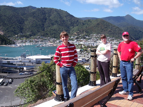
We checked into the lovely backpackers and took a walk around the neighborhood.

We went up the main hill to see the church--it was a rainy day when we were there before.

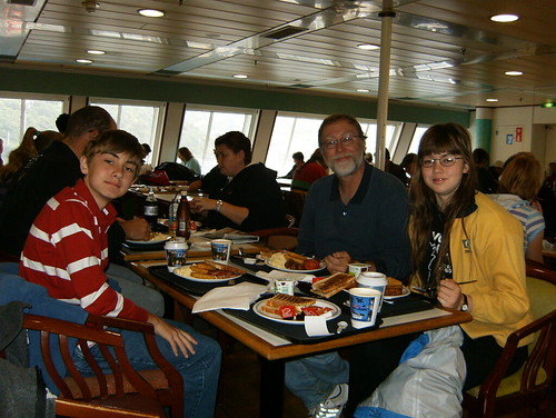
We walked about and found a brew pub for supper. We were exhausted and our land sickness was hitting hard. The tables and chairs wouldn't stop moving. Our drive had added to the feeling. Benjamin couldn't finish his dinner.

We didn't know that we could pay at the bar at any time--each place is a bit different. We chatted with the waitress, who is from the U.K.

Finally, Lucy took the kids to the backpackers while I settled the bill.

The co-owner brought me the check and explained that usually customers just pay at the bar. He was concerned that we were upset--I told him that the kids were just tired.

He and I had a great chat about how much we like NZ. He's from the U.K. and is happy to be here. We talked about the youngsters not appreciating how nice NZ is.

As he handed me the receipt, he asked "So where are you from?"

Usually, I just say 'from the U.S.' or 'from Texas.'

This time I said "College Station, Texas."

He pulled the recipt back. "Where?" He looked stunned.

"College Station, Texas" I said again, a bit louder.


"THE College Station, Texas???" he asked, incredulous.

He shook my hand hard and broke into a great smile.

"I've meet someone from College Station, Texas! Oh my! Where Robert Earl Keen and Lyle Lovett wrote the porch song! I'm a great Robert Earl Keen fan and I like Lovett too. My goodness, this is great."

So we had a long chat about B/CS and he made me promise to become a friend on his Facebook page for the bar. I did.

I went back to room. We slept off our land sickness, but we had to take the Interislander back to North Island.


Click for the Nelson Jazz Club

Day 6, We Return to Nelson

The water taxi arrived and we piled in with the other riders. The crew loaded the kayaks and away we went. Farewell, Able Tasman! The taxi returned us to Marahau, where our car was parked for the week.

The tide was out and the beach was huge. Just as I was wondering how far we'd have to walk to reach the seawall, the water taxi lurched and its engine stopped.

We heard a wench running, then, a tractor throttled up and we went on. They drove the full water taxi right up onto a trailer and a tractor was pulling us along the sand.

DSCF1477

We were back! (You can see another boat/trailer/tractor behind us to our left.)

We were wet. The wind was strong and cold.

The car was in direct sun--nice and warm.

We drove to Nelson. We didn't know that we were landsick. The up/down/left/right driving felt natural after spending 26 hours on water. It would hit us in the restaurant.

Click here for 4 photos.

Saturday, October 17, 2009

Day 6, We Worship Kayaking Beelzebub; Otto Returns

DSCF1445


The water taxi took us along the red path in this photo:

kayakpath

We paddled back to Anchorage Bay for our water taxi back to civilization.

We had a great lunch on the beach--fresh made coffee!--and spent some time sailing the kayaks. The sailing path appears in yellow.

Our instructor, Steve, had us put the kayaks together as a raft. Ben and I had a kayak at the right end and another fellow and his friend had the kayak at the left. Lucy and Emily's kayak was in the middle and their job was to hold the raft together.

Steve tied a tarp to two paddles and the other kayaker and Terry held the paddles up while Benjamin and another kayaker held the front of the tarp down. The strong north wind drove us along and saved us a lot of paddling. We were able to return to Anchorage. Without the sailing we would have stopped short and waited for the water taxi farther north.

Then, while we waited for the water taxi, we started chatting with the German fellow who was in the 3rd kayak. "Yes, I was on Waiheke Island a few weeks ago. It is beautiful. I walked all the way from Matiatia to Stoney Batter."

"You walked," Lucy exclaimed, "my, how did you get back?"

"Well an American family picked me up" he said and then took a good look at us. "You picked me up!"

Yes, we found Otto the backpacker again and spent a day kayaking with him. He was alone at Stoney Batter but had managed to meet a woman who was now traveling around New Zealand with him.

We had to get a group photo for the blog.

DSCF1472


Click here for 24 photos.

Night 5, The Backpackers Hotel Boat

When the water taxi collected us, we had finished walking for 33.0 miles. We have 47 total backpacking miles since we got here.

The backpackers hostel was a great change with supper and breakfast provided.

http://www.aquapackers.co.nz/index.php

After breakfast on day 6, our water taxi came to take us kayaking.

B DSCF1439

Click here for 6 photos.

Day 5, Backtrack from Whariwharangi to Totaranui 7.5 km / 4.6 miles

There were more groups at the last hut than at Awaroa; however, the place still felt empty.

The German fellow we saw at earlier huts rejoined us. He had crossed the Awaroa inlet at 4 p.m. and stayed in a tent rather than rise at 3:30 a.m. like we had done.

Emily and I had started a fire--the posted instructions helped--but it looked like it would die. The German fellow opened the firebox and spray some of his cooking fuel over the wood. After that, the fire was hot enough to dry and ignite any wood that we added.

An American woman arrived very late--as we were going to sleep--and she had traveled from Bark Bay to Whariwharangi in a single day. Yikes! She was tall, a fast walker, and had a light pack.

We had to get to Totaranui by 3:15 p.m. and meet our water taxi. We wanted to see Separation Point and look for seals. We had to get going.

We started with the red path until we reached the green path to the point. The blue path brought us back to the red trail. We only had to go 1/2 way.

Last Long Walk

The Water Taxi made several stops; they picked up an Aggie couple!

B DSCF1413


Click here for 29 photos.

Whariwharangi Hut -- 10 Commandments of Tramping

Among the items kept in the Whariwharangi Hut--chess set, playing cards--we found a report book from the UoA Tramping club.

The end of the line was the perfect place to find these commandments:

1. Thou shalt not wear matching polypropylene outfits.

2. Thou shalt not covet thy neighbors trail mix.

3. Thou shalt eat, drink, walk, and be merry.

4. Thou shalt dance a jig at all important occasions.

5. Thou shalt walk straight through the mud and not pussy-foot around it like a sissy little girl; what doest thou think the tramping boots are for anyway?

6. Thou shalt not soil the river.

7. Thou shalt not clean thy teeth nor shalt thou brush thy hair on a tramp.

8. Thou shalt not disrespect, abuse, or waste zip-loc bags.

9. Thou shalt not snore.

10. Thou shalt not worship false idols--for example, Canoeing Satan, or Kayaking Beelzebub.

Day 4, Awaroa to Whariwharengi 13 km / 8.1 miles

Click here for 19 photos.

If we crossed Awaroa Estuary at 4 p.m., we would face a 5 to 7 hour walk to our last hut. If we crossed at 4 a.m., we could take our time and rest during the walk.

We set our alarms to 3:30 a.m.

We packed as much as we could before going to bed and made quick work of setting out.

Breakfast would wait until daylight. We'd have our trail mix until then, and walking the trail would keep us warm.

We had one LED flashlight, one cell phone with an LED flashlight, and two regular flashlights. We started crossing at 4:20 a.m. and we were changing into dry shoes and socks by 4:40 a.m.

Lucy had set the heading on her compass before it was too dark for us to see the sign on the other sign. We followed the heading and walked right to the trailhead on the other side.

Awaroa Hut

We left the hut at 4:20 a.m. and followed the compass on a 300 degree heading.

Last Long Walk

The read trail shows our long walk to the last hut. We stopped at the lookout before Totaranui and ate.

We skipped Separation Point, we would got there on our shorter journey back to Totaranui on our last hiking day.

Day 3 & Night 3, Bark Bay to Awaroa Hut

Day 3 went well. We had another lovely walk, a stop at a cafe--yes--for desserts and beer, and a final walk through intense cold winds to the Awaroa Hut.

B DSCF1298

The wind was a surprise. Terry wondered how often the area was like this. At our final hut we would meet some trampers who told us that those were southerly winds from the antarctic. The mountains were shielding us from their full fury. Things were bad on south and north islands. Over 700 cars were stranded in unexpected snow on North Island between Napier and Taupo--we had tentative plans to visit both places on our way back to Waiheke Island.

Luckily we only walked against the cold air for 30 minutes and then we were at the cabin. We were alone and couldn't figure out the settings on the wood burning stove. Some Canadian girls saved us. Back home, they survive with nightly wood stove fires and got the kitchen warm.

Click here for 16 photos, 1 intense wind video.

Day 3, Bark Bay to Awaroa 11.5 km / 7.1 miles


The red line shows our path to the Awaroa Hut. You can see the large tidal plain to the north. Trampers must cross this plain within 2 hours of low tide. After that, the currents and depths are too great for walking.


The first tidal crossing comes from a small estuary. We walked along the beach and then turned inland at the north.


We hoped to reach the lodge before 2 p.m. The cafe has cool treats--not a bad way to spend some time 1/2 way through the walk.


After the lounge, we walked along a grass-strip airfield that took us back to the sands of the Awaroa Estuary.


This shows the estuary near low tide. Trampers cross midway between the coast and the southern end.


This image shows the estuary at high tide. No one can cross.

Night 2, Bark Bay Hut

Click here for 4 photos, 1 incoming tide video.

B HPIM2076

Benjamin standing in the bay as the tide rushes in.


Click here for 4 photos, 1 incoming tide video.

Monday, October 12, 2009

Day 2, Anchorage to Bark Bay, 8.7 km / 5.4 miles

Click here for 32 photos.

After breakfast, we packed up and moved on to Bark Bay.


Our path took us past Cleopatra's Pool and a spur track with two waterfalls; we skipped the waterfalls, but we did take the short spur to Cleo's Pool.

B HPIM1990
Some huts had these wonderful 3D charts showing the path over the hills.

B HPIM2021

B HPIM2027

Lucy noted that the bridge of doom can hold 5 persons and there were five persons there. "So let's go!" Terry suggested that we should wait until the two folks ahead of us got across. In case someone blunders up, misses the sign, and starts crossing.


The track (yellow line) brought to Bark Bay Hut (red arrow) for our second night. In this image the bay is between high and low tide. We arrived at low tide, claimed four bunks in a six-bunk room, and walked across the soggy sand to sit on the beach and watch the sea (red circle.)

Click here for 32 photos.

Night 1, Anchorage Hut

The Anchorage Hut is in the trees--I could not get a satellite image.

We shared the sleeping room with some women who are in their 60s and 70s.

The started in the north and were headed south. They gave us some good advice about the next cabin and the path ahead of us.

Sunday, October 11, 2009

Day 1, 1 October--Marahau to Anchorage 12.4 km / 7.7 miles

This map shows our drive from Picton to Nelson, and then on to Marahau.


We spent one night at a wonderful backpacker's hotel--Accents on the Park--in Nelson.

Click to visit Accents on the Park.

The Accents web page shows our room:


We had the upper room shown in the photo.

We had a big breakfast in town and drove to the Marahau offices for the water taxi and kayaking companies.

Then, we started walking.


The red trace show the approximate path to Anchorage.

B HPIM1960


Click here for 20 photos.

30 September--The Interislander Ferry and the Samoan Earthquake

We had a 7:30 a.m. sailing from Wellington to Picton. We agreed to get by on water and granola bars until we could breakfast on the ferry. The trip is about three hours long.

You can view movies of the sailings at the Interislander site. Click here.

My cellphone alarm rang and we got moving. We dressed quickly and dashed to the lobby to check out. We didn't have time to look at television or listen to the radio.

When we arrived, we saw a sign stating that the seas were calm today. Good news.

We got our ferry ticket and joined the line in lane 1. In a short time we were driving onto the Interislander ferry Kaitaki. Once our car was boxed-in by other cars, we got out and walked to the passenger stairs and started exploring the ship. Ten decks, two cinemas, two dining areas, multiple rooms with reclining seats, one bar. This was the biggest ship that we've ever been on.

Once the ship pulled back from the dock, the captain spoke over the intercom. "For those who do not know, there was an 8.3 magnitude earthquake off Samoa one hour ago. We are under a tsunami warning with the potential tsunami arriving just as we are scheduled to enter the Marlborough Sound. We are safer away from land, so we are going forward." His Swedish accent was comforting at least.

We bought breakfast in the dining hall. We wanted to finish eating before we left the calm waters in the bay and hit any rough water in the open sea.

HPIM1933

Star Trek was showing in one cinema; we sent Benjamin to see it while Lucy and Terry found three chairs together in a reclining lounge room. Emily went to the dining hall and drew. Lucy and Terry watched the reports coming from Samoa and the rest of New Zealand as government agencies and companies prepared for the tsunami. We saw live reports with the usual folks who don't think things through taking their kids to the beach to 'watch' the tsunami. A police officer on the screen stopped a woman headed to the beach with some children. "Madame, do you know there is a tsunami warning?" After she replied "yes," he said "and you're still taking children to the beach?" Oh dear.

Part way through the voyage, the captain told us that the authorities didn't want us entering the narrow Marlborough Sound. They wanted us to enter through the northern route. That had two advantages: the entrance is wider and can accommodate more water, and it would add 45 minutes to our sailing time. The second advantage was probably the real reason for the change. Instead of approaching the docks at the expected tsunami time, we would arrive at least 30 minutes later.

By now you know that the tsunami had minimal effects on New Zealand. We couldn't tell that anything was amiss at Picton. We got in the car, drove off the ferry, and made our way to Nelson.

The effects on Samoa were tragic, devastating. We wondered how many Kiwis went there during their children's school holiday.

Click here for 4 photos.

Te Papa and Parliment

Click here for 3 photos.


The sunning morning turned to another rainy afternoon. We headed back to the museum. The day before the museum was packed with families--this was the school holiday's first week--but today there were fewer visitors. They had been here yesterday and had a morning out during the sunny weather.

There were many great exhibits, but the most striking to me is the New Zealand map.


I measured the map at 20 paces from south to north. At that scale we could still see features on Waiheke Island. I could clearly see the features that Lucy saw at Cape Reinga.
B HPIM1596


Click here for 3 photos.

Saturday, October 10, 2009

The Funicular

On our way to the funicular, we found a Scout headquarters. In NZ scouting is co-ed at all levels and they have levels that keep scouts busy into their early 20s.

Click here for 7 photos.

B HPIM1906

Benjamin at a scout meeting place.

B HPIM1822

The funicular takes the bother out of the hill.

Click here for 7 photos.

Wellington Botanical Garden

Click here for all 19 photos.

B HPIM1891

B HPIM1900
After a nice walk through the garden, we headed to the funicular.

First Day in Wellington--Cajun Food??!!??

We had a short drive to Wellington. We were there too early to check into the backpackers, so we went to Te Papa museum for the afternoon.

We had the typical Wellington day: rainy, windy, gray.

We picked up our car and checked into the backpackers. We had a four bunk room on the 4th floor. It was handy and saved us time, but it was a bit wild with 20-somethings. We decided to get motel rooms outside of town for our future travels.

For now, we had two nights in the backpacker hostel and it went well enough.

We found parking on the street--free after 6 p.m., but pay-and-display after 8 a.m. Terry got up at 6:30 a.m. and went down to prepay for parking until 10 a.m.

That gave us time for breakfast around the corner.

We almost ate at a cajun/tex-mex place. Their pancakes and waffles were not ready, so we excused ourselves and left. Before we got up, I asked why the menu had Texas/Louisiana food. Our waitress told us that the owner lived in New Orleans for five or more years and had brought the dishes to Wellington.

With breakfast done and the weather looking good--by Wellington standards--we drove to the garden.

The Drive to Wellington


The blue line shows our drive to Wellington.

The red arrow points to our ultimate objective: Abel Tasman National Park

Dawn Departure to North Island

We had enough days off to allow us to have an easy start. We spent Saturday loading our backpacks for the five day walk. We put toiletries and city clothes in two small bags that we carried into the hotels, motels, and backpackers hostels during our motoring.

Click here for all 12 photos.

B HPIM1779
The sun rose over Waiheke as the ferry pulled away.


We snacked until we got some distance away from Auckland. We had a late breakfast at a lovely cafe.

B HPIM1785
The cafe did not offer a spaghetti-filled toastee at breakfast; Benjamin ate spaghetti on toast while we looked away. New Zealand, rich in carbohydrates!

B HPIM1797
We drove around Mt. Ruapehu.

We had time to see a bit of Wanganui and dine at a nice restaurant near the river.


Click here for all 12 photos.

The Drive to Wanganui

Our two-week trip would take us south. We hoped the weather would be warm enough to keep us comfortable--especially during the five days hiking the Abel Tasman coastal track.


We followed this route to Wanganui. From Hamilton southward, it took us through regions that were new to us. We passed Mt. Ruapehu on its west side.

Pre Trip Rainbow

25 September--With two days before we head south, we were treated to a full rainbow over the beach.

Click photos to get the full size at flickr.

B HPIM1769

B HPIM1770

Friday, October 9, 2009

Stoney Batter Post Script

We made our second Stoney Batter visit on 13 September.

While driving back, we turned a corner and found two cows out on the road. I was a bit worried until I noticed a young man who appeared to be walking the cows down the road.

Then, the man turned, saw us, and put out his thumb.

Oh, he wasn't walking the cows, he was just walking along with them.

Lucy said "Oh, he's a backpacker. We're on the far side of the island; let's give him a lift."

I pulled to the side and the kids moved over to let him join them in the back.

He and Lucy had a great chat while I drove us to Onetangi Beach, where he could catch a bus to the ferry.

His name was Otto. He works for a real estate company--owned by a Dutch concern--that manages real estate in Germany. He did not take the common world-tour trip after finishing university and has always regretted that. So, he convinced his employers to give him a three-month unpaid leave to take a quick trip around the world.

He had three days for the Auckland area, and friends told him he had to see Waiheke. He had walked the 17 km from the ferry to Stoney Battery and was glad that we were giving him a lift.

We dropped him at the bus stop and told him he could get something to eat and drink at the Beach cafe before the bus came. Then we drove ourselves home.

Back from Two Weeks Away

Howdy!

We're back on Waiheke Island.

For the last two weeks, you've been reading material that I preblogged so that things would post while we were disconnected.

We'll start posting all the photos from our travel to south island over the next two weeks.

We had a 5 day, 30+ mile trek on the Able Tasman costal track. We filled the other days with driving, sea kayaking, and short visits to other sites.

We'll have another long travel period in December. We won't post any updates from 11 December until we get back to Texas in January. However, we'll set pre blog information that will appear as we travel about.

It is nice to be 'home.'

We had a great time.

Return to Stoney Battery

We returned to Stoney Battery, our first Waiheke walk months ago.

This time, with sunny and warmer weather, we stayed above ground and tried to walk to down to a bay. We failed. We followed the wrong markers. Next time, we'll follow the right ones.

We found out that we are now in sunscreen weather and future hikes will require us to apply the lotion before we set out.

Click her for the photoblog.

Thursday, October 8, 2009

Reduce, Re-use, Recycle


My re-use project: a polyethylene sleeve for my palm pilot.

I lost my Palm Pilot case at Tamaki campus. I don't miss the 1 GB memory card--they are cheap--but, I do miss the music it held. That was 1/2 the music I brought on the trip. The originals are safe at home; I'll hear them again someday.

I need a case for the Palm so that I can carry it without pushing the buttons accidentally. This model is old; I would need EBay to find a case for it.

Then I noticed the 3 liter milk jugs have large, flat sides. Just the right size for my sleeve.

Some careful knife work and a bit of Sellotape later, I have a new Palm Pilot case. It's slimmer than the old case and more comfortable in my pocket. We'll see whether it protects the Palm during my commuting over the next few weeks.

Monday, October 5, 2009

Lamingtons


Benjamin and Emily are now fond of Lamingtons.

We get them in an 8-pack. Emily takes the raspberry and Benjamin concentrates his efforts on the chocolate.

Detente!

Named for the rich Briton who's cook created them for an impromptu event,* this iconic Kiwi food has a Wikipedia page:

http://en.wikipedia.org/wiki/Lamington

Girl scout cookies and boy scout popcorn are unknowns here, but Lamington drives can bring in money for scouts, churches, and school clubs.

So sad then, that Lord Lamington is reported to call them "those poofy woolly biscuits."

*One of many origin legends.

Saturday, October 3, 2009

Wear Sunscreen

Our second trek at Stoney Battery got us to buy a sunscreen vat.

Our two days going around Cape Reinga got us red-faced, but we were in the sun all day the second day.

Our short Stoney Batts time turned us red again. (I haven't blogged this yet, but I will.)

The sun is higher, the ozone layer is thin or missing.

Sunscreen is now part of our daily skin care.

Thursday, October 1, 2009

Benjamin Recovered

Some time ago, Benjamin got a serious cut at school--he's better know.

A boy grabbed scissors from Benjamin rather than waiting for them and Ben was rushed to a clinic.

This was the first day that Terry got connected to the internet at work. Just as he logged on, Terry
's top email from the morning was "Benjamin injured, rushed to medical care." The email was from the morning.

I phoned home--we were at #7--and Lucy already had Benjamin at home. His arm was in a sling but he was doing well. We updated our phone numbers with the school--they had called the realtor, who then called Lucy.

Weeks passed, Benjamin recovered, and then, he was visciously attacked by a pencil sharpener. We got him a cheap one--we thought it would last six months--and it kept breaking into smaller pieces as he carried it between school and home.

Finally, all he had was the single edge razor that was once held in a plastic housing. He cut himself while sharpening a particularly tenacious pencil.

Rushed to the nurse--a different nurse from the last time--he was receiving treatment and then she asked "just a moment, are you Benjamin?" "Yes, I am," he replied.

"Figures" she said and returned to bandaging his finger.

(He has a nice pencil sharpener now.)

No worries.

The Half-Time Show

Today we are 1/2 through our New Zealand sojourn.

We have about 100 posts over about 90 days. The blog hasn't slowed as much as I feared it would.

We now hope that we will drive on the right side of the road when we return.

My hypothesis might become a theory; the days seem faster as things become routine. I try to change things as much as I can.

Walk from the ferry to campus--I have three paths to choose.

With the warmer weather, I walk to Onetangi beach and watch the sea crash to shore before I get the bus.

Anything to shake up the routine and make our visit seem to last longer.

P.S. We haven't written about #12 and we only have a few photos. Compared to #7, #12 is warmer--insulated with modern windows that shut and seal. No fireplace, just electric heat. We needed that for the first week. It is warmer now and we're not running the heaters.

Two showers and toilets! How lovely!

We're back to the dish brigade--no dishwasher. And laundry is an adventure--washer yes, dryer no.

I was working from home recently and while Lucy and I typed away, the rain started falling.

"Rain! Take in the clothes!" I yelled and ran for the door. Lucy and pulled down the garments and moved them inside. Two steps forward, one back.